andalusia 1 350 000
Andalusia 1:350 000
This map appears in the map series world mapping project in travel expertise. Characteristic is the high-quality, clear and modern cartographic representation. Contour lines with elevation Coloured elevation levels Classified road network with distances Places of interest Detailed local index GPS capability by longitude and latitude UTM grid
937 Руб.Irland 1: 350 000
(Card can be removed and used without envelope) Polyart (tear and waterproof, writable), cardboard envelope: material Size: 26x11,5 This map appears in the map series world mapping project ™ in travel expertise. Characteristic is the high-quality, clear and modern cartographic representation. - Contour lines with elevation - Coloured elevation levels - Classified road network with distances - Places of interest - Detailed local index - Legend in four languages (Ger., Engl, French Polynesia, Span).
937 Руб.Irland. 1:350 000
High quality road maps with place name index. In many countries these are simply the best maps available. Scales vary according to the size of the country. Index is in several languages.
705 Руб.Portugal 1:350 000

This map appears in the map series world mapping project in travel expertise. Characteristic is the high-quality, clear and modern cartographic representation. Contour lines with elevation Coloured elevation levels Classified road network with distances Places of interest Detailed local index GPS capability by longitude and latitude UTM grid
583 Руб.Пензенская область. Пенза (1:350 тыс / 1:17 тыс) Карта (раскладная) (Лоцман)
Пензенская область. Пенза (масштаб 1:350 000 / 1:17 000) Карта раскладная.
86 Руб.Пензенская область. Пенза (1:350 тыс / 1:17 тыс) Карта (раскладная) (Лоцман)
Пензенская область. Пенза (масштаб 1:350 000 / 1:17 000) Карта раскладная.
86 Руб.Indian. Himalaya. 1:350 000
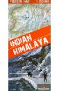
A unique map of the Indian Himalaya mountains (scale 1:750 000), detailed maps (scale 1:350 000) of 22 trekking itineraries in 10 regions of north-east India (Kashmir, Ladakh, Zanskar, Lahaul, Rupshu, Spiti, Kinnaur, Garhwal, Kumon and Sikkim), tourist and topographical information and other practical information.
1435 Руб.Spanien, Nord. 1: 350 000
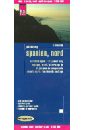
This map appears in the map series world mapping project in travel expertise. Characteristic is the high-quality, clear and modern cartographic representation. Contour lines with elevation Coloured elevation levels Classified road network with distances Places of interest Detailed local index GPS capability by longitude and latitude UTM grid
937 Руб.Карманный атлас: Москва. Подмосковье
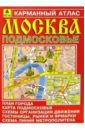
Атлас содержит план Москвы в масштабе 1:30 000 - 1:85 000, карту Подмосковья в масштабе 1:350 000, схемы организации движения, гостиницы, рынки, ярмарки, схему линий метрополитена.
77 Руб.Карманный атлас. Москва. Подмосковье
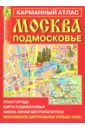
Вашему вниманию предлагается карманный атлас города Москва и Подмосковья. В атласе: План города (масштаб 1 : 30 000 - 1 : 85 000); План центра города (масштаб 1 : 15 000); Схемы организации движения автотранспорта на третьем транспортном кольце; Карта Подмосковья (масштаб 1 : 350 000).
202 Руб.Карманный атлас. Казань и окрестности города
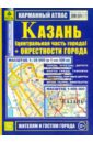
Карманный атлас поможет путешественнику быстро и легко сориентироваться в городе Казани и его окрестностях. Масштабы карт: 1:35 000 (в 1 см 350 м) 1: 500 000
227 Руб.Москва. Подмосковье. Карманный атлас
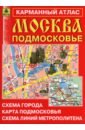
Компактный полноцветный атлас. Содержит план Москвы (1:30 000 - 1:85 000), план центральной части города (М 1:15 000), карту Подмосковья (М 1:350 000), схемы организации движения автотранспорта на третьем транспортном кольце, указатель улиц Москвы, схема линий метрополитена, московское центральное кольцо (МЦК), гостиницы и ТРЦ.
137 Руб.Москва. Подмосковье. Карманный атлас
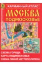
Компактный полноцветный атлас. Содержит план Москвы (1:30 000 - 1:85 000), план центральной части города (М 1:15 000), карту Подмосковья (М 1:350 000), схемы организации движения автотранспорта на третьем транспортном кольце, указатель улиц Москвы, схема линий метрополитена, московское центральное кольцо (МЦК), гостиницы и ТРЦ.
152 Руб.Киев. План города
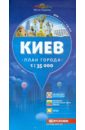
Вашему вниманию предлагается план Киева. Масштаб: 1: 35 000 (1 см = 350 м).
230 Руб.Roads & Cities Austria. Europa. SuperAtlas 1:150 000 - 1:350 000

Touristische Informationen, Ortsregister mit Postleitzahlen, Landeshauptstadte Osterreich, Hauptstadte Europa, Stra?enverzeichnis. Laufzeit bis 2013. Getr. Pag. Mit zahlr. farb. Ktn. u. Pln. 30 cm 1450g Osterreich 1:150.000 u. Europa 1 : 3,5 Mio. Spiralbindung , in niederlandischer / flamischer, italienischer, spanischer, deutscher, franzosischer und englischer Sprache. Крепление: двойная евроспираль.
1660 Руб.Швейцария. Карта. Switzerland 1:350 000
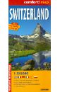
This easy-folding laminated comfort! map is durable and water resistant. Map includes up-to-date road network, places of interest, shaded relief and an index of places names. Double sided map. laminated on both sides Масштаб 1: 350 000 Легенда на 6 языках
593 Руб.(Card can be removed and used without envelope) Polyart (tear and waterproof, writable), cardboard envelope: material Size: 26x11,5 This map appears in the map series world mapping project ™ in travel expertise. Characteristic is the high-quality, clear and modern cartographic representation. - Contour lines with elevation - Coloured elevation levels - Classified road network with distances - Places of interest - Detailed local index - Legend in four languages (Ger., Engl, French Polynesia, Span).